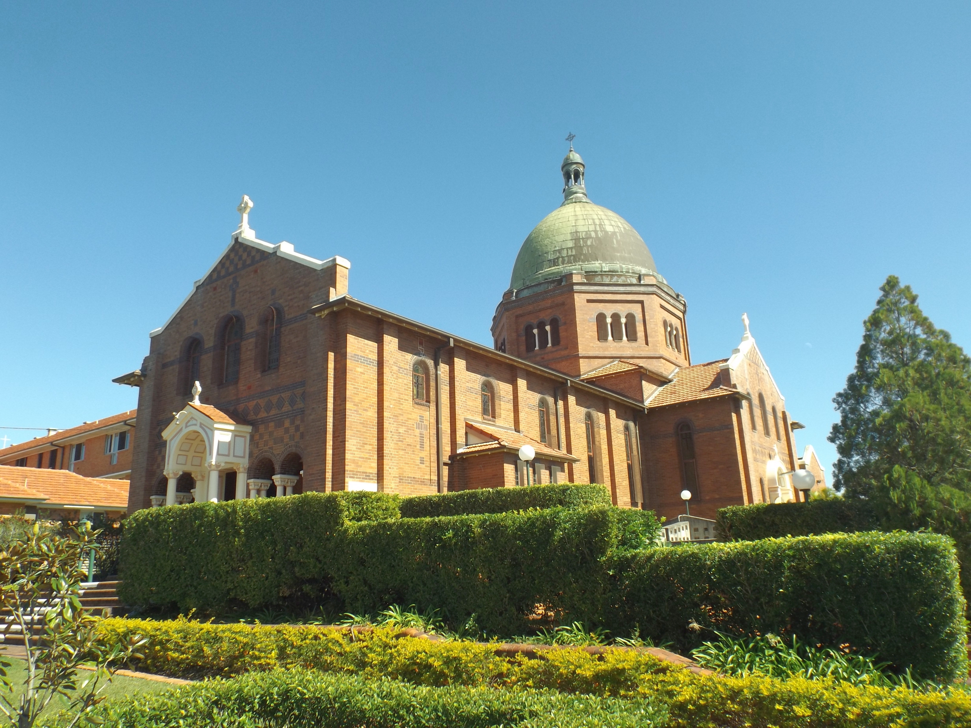
Corpus Christi Church, built 1925–26 — the copper-domed Romanesque Revival church that anchors Nundah's heritage precinct. Designed by Hennessey, Hennessey, Keesing and Co for £16,840, it's one of Brisbane's most distinctive Catholic churches and a Queensland heritage-listed landmark. Undergoing restoration in 2025 ahead of its centenary.
Zion Hill — The Mission That Started a City (1838)
To understand Nundah, you need to understand 1838. At that point, Moreton Bay was still a penal settlement. Free settlers weren't officially welcome. But John Dunmore Lang — a Presbyterian minister with grand ambitions — persuaded the colonial government to let him establish a mission for the local Turrbal people. He recruited German Lutherans from the Moravian Church, men who were both pious and practical: they could preach, but they could also build.
The thirteen missionaries who arrived in April–June 1838 were given 650 acres of land near a creek. They named their settlement Zion Hill — a biblical name meaning the dwelling place of God. The creek they called Brook Kedron, after the Kidron Valley in Jerusalem. That creek is the same Kedron Brook that runs through the suburb I wrote about in the previous post — and it connects these two stories in a way you can't plan.
The missionaries planted crops, built homes, opened a school. They tried to learn the Turrbal language and translate the Bible into it. Explorer Ludwig Leichhardt visited in 1843 and praised their work. But by 1846, the mission had failed — the colonial government withdrew funding, and the missionaries' efforts at conversion had limited success.
So the missionaries did what practical people do: they became farmers. August Rode (Rode Road), Gottfried Wagner (Wagner Road), Johann Zillmann (Zillman Road), and their families bought up the land and turned Zion Hill into a thriving German farming community. For decades, the area was known simply as German Station.
German Station to Nundah (1882)
In 1882, the Brisbane to Sandgate railway line opened. A station was built at German Station, but colonial authorities decided the name sounded too foreign. They chose Nundah — believed to be derived from an Aboriginal word describing the string of waterholes along Downfall Creek at Northgate.
The railway changed everything. Nundah became a commuter suburb, connected to the city in under 20 minutes. The Prince of Wales Hotel (1865), the school, and the surrounding farms gave way to subdivisions. Nundah became the administrative centre of the Toombul Shire, with its shire offices on Sandgate Road — now heritage-listed.
By the early 1900s, Nundah was a genuine township. The Corpus Christi Church with its iconic copper dome went up in 1925-26. The State school, originally a group of timber buildings for 700 children, was rebuilt in brick in three stages (1935, 1941, 1951). The shopping strip along Sandgate Road was bustling — fed by a tramline and a growing population.
The Toombul Effect (1967)
Then came Toombul Shoppingtown. Opened in 1967 on flood-prone land near the old Zion Hill site, the Westfield-owned centre pulled retail gravity away from Nundah's Sandgate Road strip. The shopping village that had been the heart of the community for decades became a secondary destination. Pedestrians gave way to parking lots. The strip went quiet.
It took decades for Nundah to recover. The turning point was the Sandgate Road bypass tunnel, completed in 2001, which filtered through-traffic away from the village centre. With less congestion, the strip could breathe again. Cafes started opening. The Nundah Village identity — that specific, intentional branding as a "village" rather than a shopping strip — began to take hold.
By the 2010s, Nundah had completed one of Brisbane's more remarkable retail turnarounds. The same strip that had been killed by Toombul Shoppingtown was now thriving as a boutique village precinct — independent cafes, restaurants, pubs, and specialty stores filling the heritage shopfronts.
Nundah's Sandgate Road village strip — the revitalised shopping precinct that went from quiet to bustling after the bypass tunnel. Heritage shopfronts, sidewalk dining, and a genuine village feel that you don't get in planned shopping centres. The train station is steps away, connecting residents to the CBD in 15 minutes.
Nundah Today — 13,000 People and a Village Vibe
Nundah in 2026 is home to about 13,000 people, 8.9 kilometres from the CBD. Its housing stock is mainly interwar — Queenslanders, California bungalows, and modest brick homes from the 1930s–50s — with a growing number of apartments clustered around the train station.
What sets Nundah apart from neighbouring suburbs like Clayfield or Wavell Heights is walkability. The village strip, the train station, Boyd Park, and several schools are all within a 10-minute walk of most homes. The Nundah Village revitalisation plan has added streetscape upgrades, better pedestrian connections, and a new dining precinct along Buckland Road.
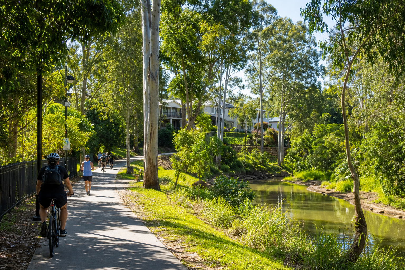
The Nundah train station is on the Shorncliffe line — frequent services to the CBD in about 15 minutes. Bus connections radiate out to Chermside, Toombul, and the airport. The Kedron Brook bikeway is a short ride south.
Schools & Amenity
Nundah has a State School (established 1865, heritage-listed, solid NAPLAN), St Joseph's Nundah (Catholic primary), and nearby access to Wavell State High School, St Rita's College (Clayfield), and Padua College (Kedron). The Nundah Historic Cemetery on Hedly Avenue contains the graves of the original missionaries — a quiet reminder of the suburb's origin story.
The Free Settlers Monument at Sandgate Road and Bage Street commemorates the 1838 landing. The Toombul Shopping Centre — the centre that nearly killed Nundah's shopping strip — is now itself facing redevelopment challenges after the 2022 floods damaged the centre severely. The irony is hard to miss.
What's Next for Nundah?
The Nundah Village Revitalisation is ongoing — streetscape upgrades, new dining options, pedestrian improvements along Buckland Road. The train station's accessibility is also slated for improvements, which will make the suburb even more attractive to commuters.
There's significant land consolidation and redevelopment planned between Sandgate Road and the railway line — a sign that the suburb's apartment stock will continue to grow. But the village character is deliberately protected: Nundah's identity as a walkable, heritage-rich, village-style suburb is its biggest asset, and the council's planning framework reflects that.
Who Should Buy Here?
Nundah is for people who want village life without isolation. It's for the couple who walks to the train station, grabs a coffee from the local roaster, and is in the city before their first meeting. It's for the family who wants a heritage Queenslander within walking distance of a good school and a park. It's for anyone who's tired of strip-mall suburbs and wants to live in a place with an actual centre — a place you can point to and say "that's Nundah."
And it's for the history nerds who appreciate that the street they live on — Rode, Zillman, Wagner, Gerler — is named after a man who arrived in 1838 with nothing but a hammer, a Bible, and a belief that this place could be something.
They were right.